
Kumano Kodo Trek in Japan - Hiking Guide & Itinerary
- Dec 5, 2024
- 18 min read
Updated: Apr 6
A Complete Guide to the Nakahechi Trail – The Most Popular Kumano Kodo Route - November 2024 [To All Posts in Japan]
Kumano Kodo at a glance
Region: Kii Peninsula, Japan
Type: Hiking between villages
Difficulty: Moderate to challenging
Duration: 4 days
Distance: 60 km | Total Accent 3800 m
Seasons: Spring to Autumn

Trips By Country
Content
More trips and Treks
Kumano Kodo Trek in Japan (熊野古道) – Hiking Guide Introduction
Planning the Kumano Kodo trek in Japan? This guide covers the main routes, itinerary options, difficulty, and practical tips for hiking one of Japan’s most famous pilgrimage trails.
The Kumano Kodo is a network of ancient routes on the Kii Peninsula, leading to sacred shrines through forests, mountains, and traditional villages. The most popular Nakahechi route typically takes 4–5 days to complete.
During our travels, we love to mix up between nature hikes, long treks, or day trips. This time, alongside Japan's day trips, we chose a longer trek: Kumano Kodo ("The Ancient Road to Kumano"). This trek spans about 5 days, including 4 walking days and 2 partial travel days (5 nights total).
The Kumano Kodo is a thousand-year-old trail network in the Kii Peninsula, south of Osaka, used by common pilgrims, emperors, and nobles. It was designated a UNESCO World Heritage Site in 2004.

The trek offers a profound connection to Japan's mountainous nature, set in an enchanted forested environment. There’s a sense of sacredness in the area, reflecting the reverence of countless Japanese pilgrims who have walked these trails over the past millennium. The experience combines merging with nature, staying in traditional Japanese homes, enjoying local cuisine, and stepping away from the hustle and bustle of Japan's big cities.
Here’s a haiku by the poet Basho, perfectly capturing the essence of this trek:
This path,
that no one walks on —
autumn evenings.
The trail network includes several routes:
Nakahechi Trail: The route we followed.
Kohechi Trail: Connects the Buddhist temples of Koyasan to Kumano Sanzan.
Ohechi Trail: Stretches along the southern coast of the peninsula.
Iseji Trail: Extends along the peninsula's eastern side.
Overview of the Trek Area: The Kii Peninsula, south of Osaka. Light blue markings indicate the trek route, while red markers show accommodations before and after the trek.
Along the Nakahechi Trail, hikers encounter 99 smaller shrines called Oji and two major shrines from the Kumano Sanzan trio, which were central to worship and prayers:
Hongu Taisha
Hayatama Taisha
Nachi Taisha
The Nakahechi is the most popular route, well-marked and continuous. Other trails may lack full signage or continuity. A trek to Koyasan (Mount Koya) is also popular, offering a unique experience of temple lodging.
For those familiar with the Camino de Santiago, the Kumano Kodo is its "sibling".
Both allow stamping a pilgrimage book, and completing both earns you a Dual Pilgrim Certificate. (more details)

Getting to the Start of the Trek
The trek begins at Takijiri-oji, a small shrine located at a crossroads with the Kumano Kodo Information Center (open 08:30–17:15). It’s recommended to arrive the day before or begin hiking later in the day if planning to visit the center.
We took a train from Kyoto to Osaka (30 minutes), then another train to Kii Tanabe (2 hours).
From there, a bus (40 minutes, departing hourly) reaches Takijiri-oji.
The center at Kii Tanabe offers detailed maps and booklets for the route, eliminating the need for additional maps.
Where to Stay the Night Before the Trek
It's best to stay close to the starting point for an early start. Accommodation along the trek should be booked months in advance, especially in spring and autumn due to high demand.
We stayed at a lovely cabin, Mine Own House (available on Airbnb), a 10-minute drive from the trailhead. The host, Kay, picked us up from the bus station, took us to a supermarket, and dropped us off at the trailhead in the morning. While the cabin doesn't provide food, it's highly recommended.

Another lodging option in the area is Guest House Kiyohime, which has excellent reviews and offers transportation from the bus station and to the trek's starting point.
If no accommodation is available near Takijiri Oji, you can stay in Kii-Tanabe and take a bus to Takijiri Oji in the morning, with a journey time of around 40 minutes.
More Trips in Japan
More World Travels
Essential Tips for the Kumano Kodo Trek
Kumano Kodo Trek Cost Breakdown (2025)
Round-trip transport (train + bus from Kyoto) for two people: $250.
Accommodation + 3 meals/day for two people (5 nights): $900.
Luggage forwarding
We used backpacks only during the trek, forwarding our main luggage to our post-trek hotel.
In-trek forwarding is available via Kumano Travel – book ahead for daily transfers between accommodations.
Kumano Kodo Dynamic Travel Packages
If you prefer a full-service experience without the hassle of booking accommodations or carrying luggage, you can book a travel package through Kumano-Travel. These packages handle logistics for you, making your trek on the Kumano Kodo easier and more enjoyable.
Kumano Kodo Tanabe – Maps and Information
Don’t forget to visit the tourism office at Kii-Tanabe train station, where you can pick up detailed Kumano Kodo trail maps. These maps are excellent, covering all walking sections, so you don’t need an additional map.
It’s also a good idea to check the Tanabe city website for updates on road or trail closures, transportation (bus routes), and other real-time information.
For a more in-depth guide, you can order the Cicerone book, “Japan’s Kumano Kodo Pilgrimage: The UNESCO World Heritage Trek,” from Amazon. It provides detailed descriptions of all the trails and additional useful tips—though it’s optional, as you can manage without it.
Kumano Kodo Flexible Trek Options and Navigation
The trek has six original sections, but most walkers do four – combining sections into single days based on fitness.
Choose full sections, partial walks, or individual segments matching your time, ability, and bus availability.
The trail is excellently marked, there’s no chance of getting lost.
You can download GPX files in advance and use a GPX viewer as needed (files are attached here).
Kumano Kodo Solo Hiking Safety
You can walk alone on the trail (including women). We saw quite a few solo female hikers on the trail. I suggest getting a local SIM card in case of emergency calls. The following numbers are for emergencies:
119 – medical emergency, 110 – local police, 050-3816-2787 – tourism center
When to trek the Kumano Kodo
In spring and autumn, which are recommended walking seasons, 2 liters of water per person is enough (on some days, even less).
Recommended trekking months:
Spring: Mid-March to end of May
Autumn: Late September to end of November.
What to pack
You can walk with just a daypack (if you carry minimal gear and clothes) or send your equipment ahead using an equipment transport service, or stay in one place and move around by bus (which takes time at the beginning and end of the day).
You don’t need many clothes, usually, there are washing machines at most accommodations (sometimes even drying).
Booking accommodation & Transportation info
To book accommodations and get essential info, use Kumano Travel – the central hub for Kumano Kodo (no official trek site exists).
They offer organized tours, accommodation bookings, equipment transport, and village bus schedules. You can also find stays via Google, Booking.com, or Airbnb.
It's important to book accommodations months in advance (availability is limited, and the number of hikers increases yearly).
Kumano Kodo Stamp Rally
For stamp collectors, there are boxes along the trail with stamps (you need to buy the stamp booklet in Kii-Tanabe, where you also pick up the trail map booklet).

Day-by-Day Itinerary for the Kumano Kodo Nakahechi Trail
Day 1: (Takijiri-Oji - Tsugizakura-Oji)
Day 2: (Nonaka - Hongu Taisha)
Day 3: (Hongu Taisha - Koguchi)
Day 4: (Koguchi - Nachi Taisha)
Day one: from Takijiri to Nonaka
Difficulty: Hard | Total Accent: 1250m
Distance: 17 km | Total time: 7 hours
Net walking time: 5.5 hours
More: Water refill available at Takahara

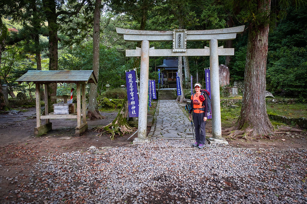
Kay picked us up at 7 AM and drove us to the starting point of the trek at Takagiri Oji. Here, we’re still smiling prior to the steep ascent that awaited us :)
Here we begin... with a steep climb, but we have strength, we’ve just started. Isn’t the picture like something from a fairytale forest? I called the trail a “Journey of roots” now you can see why, right?

We walked uphill for about 4 km to the village of Takahara, a charming village with restrooms, vending machines, and terraced rice and vegetable fields.
There’s also a woodworker with cute pieces on display. You can split the day and finish in the village for those who find it difficult to complete the 17 km of the day.


They even thought of a shoe repair kit here (perhaps for those coming from the opposite direction). After all, we’ve only just started, right?

After walking about 13 km, we arrived at the village of Chikatsuyu, where we had coffee and enjoyed delicious muffins (see the picture below). We also managed to withdraw cash from the ATM (we had forgotten that we needed to pay for the night’s accommodation in cash).

The view is stunning, and most of the hike is through a forest of tall trees. The trail can be challenging at times due to tree roots, but the signage is perfect and clear, with markers every 500 meters showing the section number and direction, ensuring no chance of getting lost.
Eventually, you arrive at the village/area of Nonaka and reach Tsugizakura-Oji, where the ancient cedar trees evoke a deep sense of awe.


From there, we continued a bit further to Guest House Mui. The host has two rooms for guests. We slept on the floor, and the bathrooms/showers are shared (it's a traditional Japanese house). Everything is clean and comfortable.
The dinner here was excellent, with six amazing and delicious dishes.
The next morning, after breakfast, Kumi drove us to the Log Bridge, shortening the original 21 km route by about 5 km (which is quite common, so no need to feel guilty).


Interactive Google map of the first day's route (Takijiri to Nonaka)
Where to stay in Nonaka
We stayed at Guest House Mui, which isn’t listed on booking platforms, so you’ll need to email Kumi to reserve a spot (Kumi's site). She opened the guest house about seven years ago after moving from Tokyo.
You can also check out the Old Trail Guesthouse, listed on the Kumano Travel website. When booking accommodations on Kumano Travel in the Nonaka area, be mindful of the distance from your stopping point to avoid walking too far.
Back to start of Day One
Day two: from Nonaka to Hongu
Difficulty: Moderate | Total Accent: 780 m
Distance: 16 km | Total Time: 6 hours
Walking Time: 4.5 hours
More: Bring water and food

As mentioned, Kumi took us to the log bridge after saying goodbye to her two goats, saving us a 5 km walk (though you can walk the full route if preferred, but we felt it was a bit long, so we decided to shorten it).
The location of the Log Bridge is marked on the map you’ll receive.
For those who find the hike challenging, you can shorten it even more by walking only from Hosshinmon-oji to Hongu, which is about 7 km. Kumi can also drive you there, or you can take a bus.

The walk is challenging, starting with a 200-meter climb over a distance of about 1 km. After a descent, there's another climb to Mikoshi-tuge, followed by a downhill stretch toward Hosshinmon-oji, where you'll find a bus stop and even a vending machine with drinks and water.
There are no restaurants or cafes along the route, so it's important to bring water (2 liters per person should be sufficient).

We ate the lunchbox Kumi prepared for us, which was excellent, accompanied by three Australians who also had lunch boxes. There are quite a few Australians here; Japan is a relatively close destination for them, and it is definitely a winter vacation spot for skiing (their summer). It's a bit confusing, right?


Do you see that small car? The man inside lives and travels in the area, and maybe he's a permanent traveler. He simply said hello and agreed to take a photo.
The day's path had a lot of flowing water, and unfortunately, the autumn colors weren't at their peak yet. All the maple trees still had green leaves.
We continued downhill to Hongu, where we visited Hongu Taisha, the most important temple of the Kumano Sanzan trio. The temple complex there is beautiful!
We ended the day at Yui Guesthouse, where nearly everything was closed since it was Wednesday. We bought instant ramen noodles from the supermarket and had them for dinner.
You can reach villages with beautiful public onsens, like Yunomine Onsen, just 15 minutes by bus, where you can bathe in one of Japan's oldest onsen.


Hongu is a charming town featuring Japan's largest torii gate (Oyunohara Torii), surrounded by rice fields. There are a few restaurants and a quirky supermarket, but that's about it.
Many hikers, like us, are seen searching for a place to eat or just grabbing some ice cream after a long day of walking.
Interactive Google map of the second day's trail (Nonaka to Hongu)
Where to Stay in Hongu
We stayed at Yui Guesthouse, which can also be found on Booking. The host kindly allowed us to stay an extra night when we couldn’t reach our third accommodation. There's no food provided, but guests can cook in the kitchen and make coffee or tea. Ingredients can be bought at the supermarket.
For more options in the Hongu area, check Kumano Travel’s website.
You can also stay in Ukegawa, just 3 km from Hongu, and continue the trek the next morning.
Back to start of Day Two
Day Three: Hongu to Koguchi
Difficulty: Easy-Moderate | Total Accent: 700m
Distance: 12.5 km | Total Time: 4.5 hours
Net Walking Time: 3.5 hours
Water: None along the way, Food: None along the way

We took a bus to Ukegawa at 8 AM from the Hongu station, where the trail officially starts (saving a 3 km walk along the road).
The ride took 10 minutes, and there was even a mini-market open in Ukegawa, so we stocked up on sandwiches, rice triangles (Onigiri) and sweet buns for the journey.

Today's walk was relatively short, and the climb was manageable, so it was an easy day. Since we were returning to sleep in Hongu, we emptied our backpacks and left most of our things at the guesthouse.
Originally, we had booked a place near Koguchi, but since the owner didn't contact us, we canceled the reservation (I spoke with Airbnb customer service), and the owner of our guesthouse in Hongu kindly allowed us to stay in another old house of hers.

We walk through the forest "as usual", occasionally spotting distant mountain views. Today, there are no villages along the way, so there are no food options available.

Water – about 1.5 liters per person is sufficient. It’s cooler today, so we aren’t sweating much. We met more travelers from Australia and New Zealand, and it was nice to chat. Towards the end of the trail, we passed through the village of Kowaze, and I thought we had already reached Koguchi.
After Kowaze, we walked another 800 meters and arrived (after the bridge in Kowaze, turn right).


Koguchi has little to offer, with just a small grocery store selling ice cream and basic items. The river is beautiful, and you can dip your feet under the bridge, the brave can even swim, though it's quite cold. Two young hikers from Finland took a short swim, Being Finnish, they had an unfair advantage!
The village, like many rural areas in Japan, is slowly emptying as its younger population moves to larger cities. Two schools have already closed, and one now serves as a guesthouse for Kumano Kodo hikers. It's a bit sad, but reflects the global trend of rural depopulation.


We waited for the 16:10 bus, and the time passed pleasantly by the river. On the way back to Hongu, we had to change buses once, which took about an hour. We found a decent open restaurant in Hongu which was fun.
We spent the night in a traditional Japanese house owned by our guesthouse host, and it was just us in the house. It was a strong, immersive experience, connecting with the place and the trail while staying in such a home.
Interactive Google map of the third day's trail (Hongo to Koguchi)
Where to Stay around Koguchi
We didn't stay in Koguchi, but you can explore Kumano Travel’s website for accommodation options in Koguchi.
Back to start of Day Three
Day four: Koguchi to Nachi Taisha
Difficulty: Hard | Total Accent: 1120 m
Distance: 14 km | Total time: 6.5 hours
Net walking: 4 hours
Water: None along the way, Food: None along the way


In the morning, we returned to Koguchi by bus. We took bus number 53 to the Kanmaru station, waited there, and then switched to bus 65 to Koguchi, starting our ascent from there. (Use the bus schedule sheet for reference).
Along the way today, there are no villages or food options (you need to prepare in advance), but there's a small store in Koguchi. The store owner even made us coffee when she saw we were struggling with caffeine withdrawal.

The first part is about a 5 km uphill trek. It starts with a gentle incline for about 2 km, then turns into a steep, "endless" ascent for nearly 3 km. It's the hardest day of the trek, so take your time if it's tough.
You'll walk through a forest with streams and changing vegetation, but expect plenty of heavy breathing along the way. Don’t worry, the uphill section eventually ends!


After reaching the top of the climb, the path levels out for about 4 km with a few additional small ascents, followed by a descent leading to a collection of temples with a waterfall (Nachi Taisha). This is not just any waterfall—it is the tallest in Japan, standing at 133 meters.


To our disappointment, the three-story pagoda which is part of the Seiganto-ji Temple is under renovation for the 20th anniversary of the Kumano Kodo pilgrimage. It's a bit of a letdown since it's the final image, but it is what it is.
Although there are many pagodas in Japan, none require a 1200-meter climb to reach. Still, despite the renovation, the temple complex (a mix of Shinto and Buddhism) and the waterfall are stunning! The renovation is expected to be completed by the end of December 2024.


After celebrating the end of the trek with uniquely colorful ice cream, we took two buses to Shingu, where we booked a lovely guesthouse for the night.
In Shingu, you can find Hayatama Taisha, the third temple in the Kumano Sanzan, if you still have energy. We stayed in a renovated old barn, which was a fun and highly recommended experience for future travelers (Airbnb link)

You can also stay in the town of Nachi-Katsuura, which is closer to the temple complex. It offers public onsens and several ryokans for those looking for a relaxing post-trek experience.
Interactive Google map of the forth day's trail (Koguchi to Nachi Taisha)
Back to start of Day Four
FAQ – Kumano Kodo Trek
❓When to trek?
We hiked in mid-October and had a few rain-free days with full sunshine. Mornings and evenings were cool (10-15°C) with daytime temperatures reaching up to 22°C. Be prepared for rain (autumn is the "driest" season in Japan). The trail is mostly shaded by forest, with some sun exposure in villages and rest areas.
Recommended trekking months:
Spring: Mid-March to end of May
Autumn: Late September to end of November.
❓Who is this suitable for?
First and foremost, it’s for nature lovers and those who enjoy long hikes. As mentioned, almost anyone can find a section or part of the trail they can manage. The full route, however, is best suited for experienced hikers with good physical fitness.
Difficulty:
Long daily distances (~15 km)
Elevation (~3800 m total — from your post)
Non-technical but demanding
❓What Clothing Should You Bring for the Kumano Kodo Trek?
Most accommodations have washing machines and sometimes drying options, so you don’t need to pack a lot of clothes. Towels, toothpaste, slippers, and even pajamas (Yukata) are usually provided.
All accommodations have air conditioning, so if you do laundry without drying, the air conditioner will get the job done.
❓What Clothing Should You Pack for the Kumano Kodo Trek in October?
Waterproof hiking shoes, 2 pairs of good socks, long hiking pants, hat, 2 quick-dry t-shirts, 2-3 underwear, fleece/light jacket, long-sleeve base layer, gloves, and a light rain jacket.
In the morning, wear a thin long-sleeve shirt, fleece, and gloves if it's cold.
Rain can occur during any season in Japan. It’s advisable to check the weather forecast for the trekking days in the various villages and prepare accordingly.
❓What Food Options Are Available on the Kumano Kodo Trek?
If you book a guesthouse, it typically includes dinner, breakfast, and a packed lunch. If no meals are provided, you can buy food along the way or at a supermarket for the evening and next day (sandwiches, rice, or instant meals).
For vegetarians or those with special dietary needs, it's best to bring your own food. Also, pack snacks like bananas, apples, nuts, or biscuits for energy throughout the trek.
❓Is Water Available on the Kumano Kodo Trek?
We used hydration pouches with a capacity of around 2 liters per day. Some days, you can refill at specific points detailed in the daily breakdown of the trek.
Many places along the route have drink vending machines, rest areas, and usually restrooms.
The booklet/map you receive at the Kii-Tanabe train station provides full details on where to refill and the amenities available in the villages along the path.
❓How to Get to the Kumano Kodo and Where Does the Trek End?
We traveled by train from Kyoto via Osaka to Kii-Tanabe and then took a bus to Takijiri-Oji. After completing the trek at Nachi Taisha, we took a bus (with one transfer) to Shingu and stayed there. From Shingu, we returned to Osaka by train to continue our trip.
For those planning to do shorter sections of the trek, it's possible to drive and stay halfway, for example, in Yunomine Onsen, which has onsens, and then explore from there.
❓How Do You Navigate the Kumano Kodo Trek?
The trail is well-marked, with no confusing turns—just follow the signs (and you can ask fellow hikers if needed). We recorded our hikes and attached the GPX files here.
You can use the GPX Viewer app (free for iPhone) or similar apps for Android. Load the track files to check your location on the trail, even when offline.
❓Do You Need Cash on the Kumano Kodo Trek?
Make sure you have enough cash as some accommodations may only accept cash payments (unless booked through regular platforms). Cash is also needed for laundry, vending machines, temples, and small shops or restaurants in villages.
There are ATMs in post offices, such as in the village of Chikatsuyu on the first day of the hike.
❓Is There Internet and Mobile Reception on the Kumano Kodo Trek?
I bought an eSIM from Sakuramobile. Dorit bought a local SIM from Mobal for calls (note that the process for receiving the SIM was complicated). Both the eSIM and local SIM worked well throughout our stay in Japan. During the trek, there is often no cellular signal.
All accommodations have internet, and you can charge your devices (just remember to bring adapters for Japanese sockets in case needed).
❓What Gear Do You Need for the Kumano Kodo Trek?
Backpacks (40-50L, depending on clothing; some can manage with smaller 30-40L daypacks)
Hiking poles
Japanese plug adapters for charging devices
Sunscreen (optional, as most walking is through forests)
Medications, band-aids, or personal comfort items
Waterproof bags (for keeping passports and money dry)
Wet wipes
Clothespins
Small towel (for drying feet after river dips or wiping sweat)
Optional: Coffee kit for enthusiasts
❓What Photography Gear Should You Bring for the Kumano Kodo Trek?
I kept it light, taking just one zoom lens (16-80mm), which was more than enough. I also packed two memory cards, two camera batteries, and a charger.
I bought a camera clip that attaches to the front strap of my backpack, which was really convenient (I got it in Kyoto, but it’s also available in Tokyo).
❓What Transportation Options Are Available for the Kumano Kodo Trail?
There's a bus network connecting villages and towns in the area. Buses can help shorten walking distances (for example, starting from Okugama instead of Hongu, saving 3 km). If you’re staying in a central village, buses can also take you to the start of a trail and back after your walk. Bus routes and schedules are available online.
Look for the village or area you need in one of the links on this page. The buses are quite punctual (it’s Japan, after all!).
Note that payment is in cash at the end of the trip.
❓How Difficult Is the Kumano Kodo Trek?
The trail we took covered about 60 km with a total elevation gain of 3,800 meters (roughly 15 km and 950 meters of ascent per day). Despite not carrying heavy packs, the trail is not easy. However, it is non-technical, with no boulders, ladders, or spikes, and is well-marked and clean. I recommend bringing light gear to reduce weight and make the hike more comfortable.
❓Where to Stay on the Kumano Kodo Trek?
In the villages, you'll find guesthouses/hostels, usually including meals (for an additional fee). Breakfast is typically served from 7:00 to 8:00, and then it's time to hit the trail.
We booked all our accommodations in advance via booking platforms like Booking, Airbnb, or email. It's a good idea to double-check your booking with the owners a few weeks ahead of your arrival. Most accommodations offer towels, shampoo, soap, and a washing machine (confirm in advance).
The food and accommodation are mostly in a Japanese style (more on accommodation options here)
You can also camp in designated areas (not on the trail itself). see camping on the Kumano Kodo
Kumano Kodo GPX navigation files here
The First day
The Second day
The third day
The fourth day


I really like the images you create. You mention using only a 16-80mm zoom. What camera body are you shooting with?
Correcting your information about the Pagoda at Nachisan. The Pagoda is not the temple. The Sieganto-ji Temple is up the hill near the large Shinto shrine, Kumano Nachi Taisha, which is one of 3 sacred sites on the Kumano Kodo. There is also a beautiful shrine, Hiro-jinja at the base of the falls.