
Sierra de Francia Travel Guide: 3 Days of Hiking in Spain
- Jun 24, 2025
- 12 min read
Updated: Apr 6
March 2025 [See all posts from Spain]
Sierra de Francia at a glance
Region: Castilla - León: Sierra de Francia
Accommodation: The village of Sotoserrano
Difficulty: Easy to moderate
Duration: 3 days
Season: spring, summer and autumn

Contents
Discovering Sierra de Francia
Located in the province of Salamanca in Castilla y León, the Sierra de Francia Nature Reserve (Las Batuecas–Sierra de Francia) combines scenic hiking trails, traditional villages, and peaceful natural landscapes.
We spent three days traveling in this area before continuing on to the Jerte Valley region (Jerte). This trip was part of a longer journey through Spain that began in Seville and ended in Madrid.
I recommend including the Jerte Valley in your trip to this region—the distance between the two areas isn’t huge.
In the orientation map attached, you’ll be able to see our hiking routes, the villages, the viewpoints we visited, and also where we stayed. For each day of the trip, there’s a detailed map and a navigation file included.

We did three out of the four hikes that are defined as “art in nature” trails. We visited villages that we started the hikes from, as well as villages we passed through during the hikes.
In addition, we hiked a trail and visited a viewpoint over the Alagón River (Alagón), where it curves and creates one of the most beautiful sights in the area.
The hikes aren’t difficult and are also suitable for traveling families.

On the reserve you also pass several long trails, like the GR-10 Travesía de la Sierra de Francia, which pass through some of the villages we visited during our day hikes.
Don’t confuse it with the long GR-10 that stretches along the northern border of Spain and the southern border of France, known as the Pyrenees Trail.

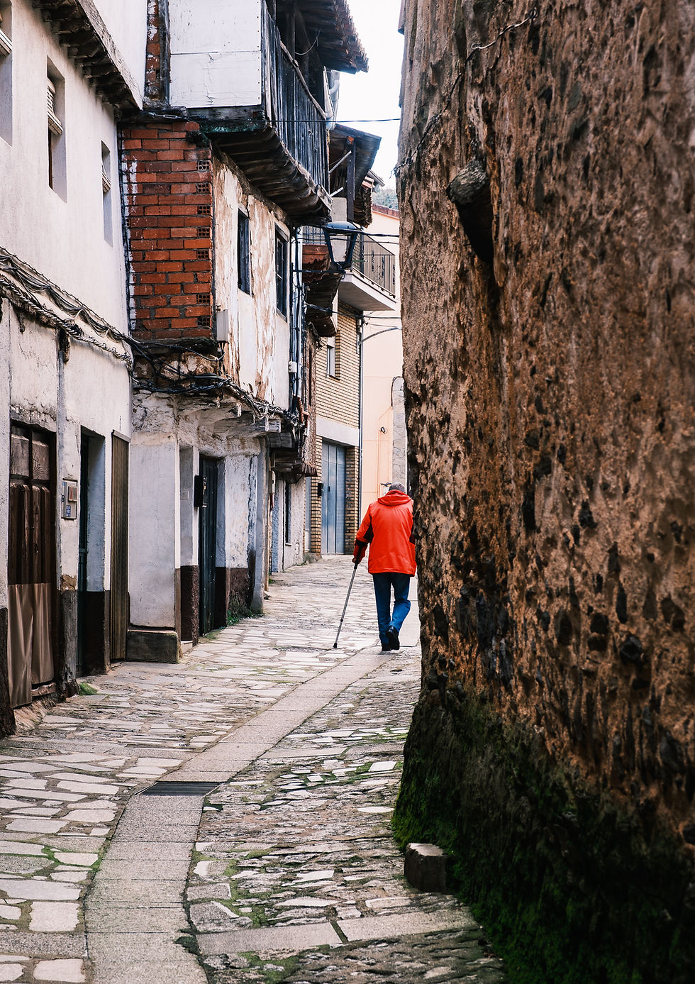
The area is beautiful and not too large, so it’s easy to arrive from village to village within a reasonable time. The roads are excellent and fairly empty. The villages are mostly built on hills, with cliffs dominating the view, making the scenery impressive.
The traditional houses in villages like Mogarraz, La Alberca, and Miranda del Castañar are built in a unique and stunning style that dates back to medieval times.

Some of the buildings combine three main elements: local stone at ground level, exposed wooden frames on the second floor, and white plaster or mud between the beams—a combination that gives them a warm, harmonious, and especially picturesque appearance.

The upper floor usually protrudes slightly outward (a style called entramado), and it features small wooden balconies, windows with flower boxes, and steep red tile roofs that protect from rain and snow.
Many of the houses bear religious symbols, traditional inscriptions, and sometimes even Jewish or Arab symbols, reflecting the multicultural history of the area.

This architecture is not only beautiful – it’s adapted to the mountain climate and continues to exist as part of the local heritage, even in new construction (which is almost non-existent).
It’s an inseparable part of the area's charm.
For More Treks
Extremadura, Spain
But despite all this beauty, it’s sad to see the area emptying out of young people who leave to seek their fortune in the big cities, leaving the elderly here in the villages—some of which are gradually being abandoned and even falling into ruin.

Travel & Hiking Tips for Sierra de Francia
Essential Information Before You Visit
I suggest renting a car and a house in the area so you'll have a base for day trips.
Having a house allows you to cook and do laundry for yourselves.
In the villages around here, there isn’t a big selection of restaurants (definitely not for breakfast or dinner).
We traveled at the end of March, and the villages were quite empty – it’s possible that between April and June, the restaurant options would increase

Car and accommodation rentals
We rented a car from Seville airport (this time from Alamo) through the Economy Car Rentals website and returned it in downtown Madrid. (With this company, it’s always cheaper to pick up the car from the airport.)
We rented a house in the village of Sotoserrano, on the border of the reserve. The house is wonderful and can accommodate a large family (3 bedrooms). It has everything. I’m attaching a link from Airbnb.
From here, we set out for hikes every day. The distance to the trailheads weren't long, making it easy and quick to get there.
Best Time to Visit Sierra de Francia
The recommended hiking seasons are spring (April–June) and autumn (October–November). You can also hike in summer, but it’s much hotter and in winter, the area is snowy.

Food, Groceries & Supplies Tips
In the villages, it’s hard to find groceries (when we were there, the grocery store was closed). The best place to shop is in the village of La Alberca.
Note: stores are closed between 2:00 PM and 5:30 PM (siesta time).
There’s a gas station at the northern exit of Alberca.
If you can, I suggest buying groceries before arriving in the area so you don’t end up unable to prepare food.

Tourist Information & Hiking Resources in La Alberca
In La Alberca, there is a tourist information office in the village’s main square (Plaza Mayor), where you can find maps and information about hikes and activities in the area. It’s worth visiting to get maps and explanations if needed.
Hiking Resources & What to Pack
Additionally, there’s a useful website (in Spanish) where you can find hiking trails in the area—including the ones we followed—along with other outdoor activities.
Another helpful resource is the official Salamanca province website, which also features a variety of marked trails and route information.
For our day hikes, we carried a small daypack with light/warm layers and about two liters of water per person. During the hotter months, you’ll need to bring more water.
If you’re visiting in March, keep in mind that mornings can be very cold—be sure to pack warm clothing.
A quick jump to the hiking days in Sierra de Francia
The first hike (Camino de las Raíces)
The second hike (Camino de los Prodigios)
The third hike (El Camino del Agua)
First Hike – The Path of Roots (Camino de las Raíces)
Part of the "Art in Nature Trails"
Difficulty: Easy | Type: Circular | When: All year round
Ascent: 180 m | Maximum altitude: 750 meters
Length: 8 km | Time: 2.5 hours
Signage: Posts with the trail symbol – Roots

Where the trail begins: The trail starts on an internal road in the village of La Alberca, right here.
About 15 km from our village (15 minutes’ drive). The trail is circular, so it ends back in La Alberca (we walked it counterclockwise).
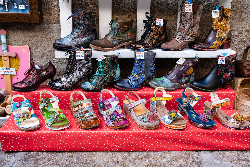
La Alberca is considered one of the most beautiful villages in Spain, and it’s worth strolling through its narrow streets, sitting in the Plaza Mayor for a coffee, and browsing the shops and special products it has to offer.

The village was the first in Spain to be declared a National Heritage Site in 1940, and it preserves local traditions, including religious festivals, traditional costumes, and unique local food.

In the area, you can enjoy dishes like Jamón Ibérico and smoked sausages, which come from pigs raised in the rural surroundings.


Our Trail of Roots is sprinkled with six art installations scattered along the way.
It’s late winter now, and the trees are bare.
There’s been a lot of rain lately, so the ground is a bit muddy but still easy to walk
The sky is bright blue, and the sun occasionally breaks through the clouds, making the colors especially beautiful :)


The hiking trail and the trail’s symbol
Aside from the art installations, the trail also passes by a small, beautiful church, and later on, a charming little lake.
When you reach the half-ruined structure (point number 4), the view opens up to the east.


Here on the right is the beautiful lake we passed along the way

Here’s the trail description from the Salamanca Province website.
At the end of the hike, you return to the village of La Alberca, where you can grab a bite to eat, wander through the beautiful alleys, or simply sit for a coffee in the main square.


Navigation file in GPX format
Second Hike – The Path of Wonders
(Camino de los Prodigios)
Part of the "Art in Nature Trails"
Difficulty: Moderate || Type: Circular || When: All year round
Ascent: 550 m || Maximum altitude: 800 meters
Length: 10.2 km || Time: 4 hours
Signage: Posts with the trail symbol – Eye

Today’s hike starts in the village of Miranda del Castañar.
Where the trail begins:
The trail starts here, inside the village.

Miranda del Castañar is one of the most charming and authentic villages in the Sierra de Francia area.
The village is located on a hill surrounded by chestnut forests (Castaños) and preserves an ancient look that takes visitors back hundreds of years.

The most prominent structure in the village is the 14th-century castle, built as part of the regional defense system.
Around the castle, sections of the original walls remain, with four gates that are impressively preserved.
The village center is made up of narrow stone alleys, typical houses with exposed wooden frames, and small squares.

In the main square is the Plaza de Toros, one of the oldest bullrings in Spain, built right into the village streets.
A short walk away is the Church of Santiago and Saint Martin, which has an impressive bell tower.

We set out around 10:00 in the morning for the hike and managed to have coffee at the village cafe.
There’s no problem with parking, and you can park anywhere allowed in the village.

Today’s walk is themed around many beds in nature and other installations. Each installation is meant to provoke thoughts about the connection between humans, myth, and nature.
The beds symbolize rest in nature — a poetic invitation to “rest,” “dream" or “surrender” to the surrounding landscape.


Most of the walk is on stone-paved paths, and part of it is on a paved road.
The trail isn’t easy, but not particularly difficult either. It’s well-marked and clear.
Along the way, you can also see to the east the snowy mountain range of Sierra Béjar, which is a stunning sight.

There are also benches here with inscriptions—quotes, thoughts, or passages inviting the hiker to stop, sit, read, and reflect.

A few examples:
“Whoever listens to the forest, listens to their own heart...”. “Every path is a journey inward, to yourself...”.
“You don’t walk to arrive — you walk to feel...”.
“Life isn’t measured by the number of breaths you take, but by the moments that take your breath away...”.


Maybe they’re clichés, but the mix of installations in nature—and sometimes in spots hidden from immediate view—creates a connection and also sparks reflection...
In short, the combination is interesting and enjoyable.
About halfway through, after roughly five kilometers, you pass through the village of Villanueva del Conde, which is a charming village on its own.

We took a lunch break in the village at a bar/restaurant, where the owner made us two omelets and, of course, coffee with milk.

We also met an elderly couple there and chatted in our basic Spanish.
It’s always nice to talk with the locals and try to learn something new about the place.


The villages in this area share a similar architectural style; some houses are very old, while others are more recent.


Inscriptions praising the “fifths” or the conscripts from certain years — during those years, every fifth man of recruitment age was drafted, so the praise is for the groups of one in five who joined the army.


On the way back, we saw many vultures soaring above us, and after a while, we understood why—they were feeding on a goat carcass.
When we got closer, they took off in a spectacular flight formation... Wow, there were about 10 vultures, and I couldn’t get a photo because the trees were in the way.

Today is a sunny day with some clouds, and the trees are beginning to bud— even the cherry trees are starting to bloom.
The streams are flowing strongly thanks to the crazy amount of rain we’ve had in the past few weeks.


There was nowhere to eat in the village, so we drove back to Sotoserrano. On the way back, we found an excellent meat restaurant called Restaurante El Molino by the Francia River.

Navigation file in GPX format
Third Hike – The Water Path (El Camino del Agua)
Part of the "Art in Nature Trails"
Difficulty: Easy+ | Type: Circular | When: All year round
Ascent: 200 m | Maximum altitude: 800 meters
Length: 7 km | Time: 2.5 hours
Signage: Posts with the trail symbol – Camino del Agua

The walk begins in the village of Mogarraz.
Where the trail begins:
The trail starts here on the road at the exit of the village.
You can park inside the village and walk to this point.

As we wandered through the village’s inner streets, we noticed dozens of portraits painted on the walls of the houses. After asking around, the story became clear...
In 1967, all the villagers were required to have their photos taken for new ID cards under Franco’s regime.
The local photographer, Alejandro Martín, took photos of about 388 villagers that year.

In 2012, the artist Florencio Maíllo, a native of the village, decided to turn these photos into a public art installation called El Pueblo de las Caras — The Village of Faces (the faces are paintings based on the ID photos).
Honestly, it seemed a bit creepy to us, but it’s one of the attractions that draws tourists to the village and symbolizes memory, heritage, and community connection.


Today’s hike is themed around chairs... placed along the trail inviting hikers to sit for a moment and observe nature.
There are also other installations and water features—you walk alongside flowing streams and beautiful waterfalls on the Bocino River and the Milano Creek, while occasionally catching views of the Bejar mountain range (Sierra de Béjar).


The circular trail starts from the village of Mogarraz, passes through the village of Monforte de la Sierra, and returns to Mogarraz.
The walk is quite easy and enjoyable, accompanied by the installations along the way that add an extra dimension of connection to nature.


The hiking trail on the Salamanca Province website here
Navigation file in GPX format
A special viewpoint over the Alagón River

Today we visited the famous viewpoint over the Alagón River (La Antigua Lookout).
You get there via the village of Riomalo de Abajo, then continue about a 7-minute drive on a narrow but steady road (3 km).
It’s best to come in the afternoon when the sun in the west allows for good photos, or very early in the morning when the sun doesn’t interfere with photography (photos are taken looking west to east).
Luckily, the river flow was impressive, and so was the view. :)

More hikes in the Sierra de Francia area
The fourth hike on the Art Trails is Bosque de los Espejos (The Forest of Mirrors), which is 9.2 km long and passes through the villages of San Martín del Castañar, Sequeros, and Las Casas del Conde. Details here (in Spanish).
The Three Rivers hike (circular) starts right from the village of Sotoserrano (Route of the 3 Rivers in Sotoserrano). Details here (in Spanish).
On this website, you can choose more trails in the Sierra de Francia area. The site is in Spanish, but you can translate it into English. Most trails include navigation files and an excellent map.


Comments